


fig5
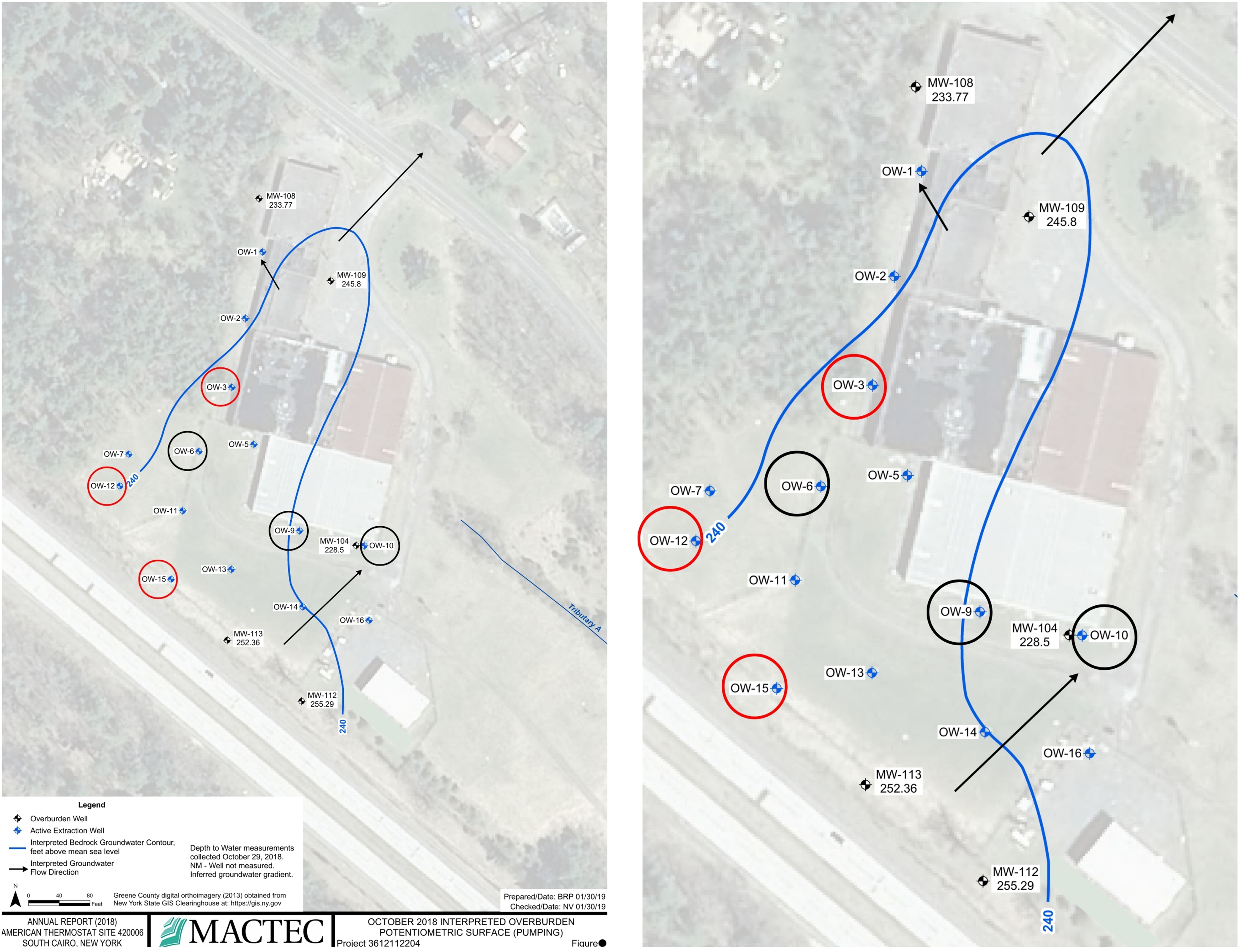
Figure 5. Map of groundwater wells and direction of groundwater flow at the American Thermostat site from page 10, including a zoomed-in version on the right panel, from the Fourth Five-Year Review Report Addendum American Thermostat Superfund Site[20]. The 3 wells depicted in Tables 1 and 2 are circled in red; the other 3 wells depicted in Supplementary Table 1 are circled in black. Figures came from publicly available government reports[20] and are not copyrighted.