


fig1
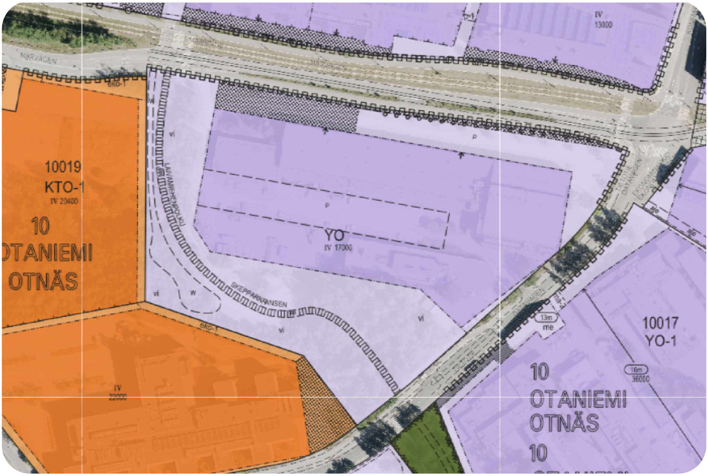
Figure 1. Existing zoning plan[69] of the case block, indicating designated land uses: educational buildings (YO) with a gross floor area (GFA) limit of 17,000 m2, parking areas (p), a public green corridor (vi), and a biking route (pp). Dashed-dot lines indicate the permitted building boundaries. Small arrows pointing toward the dashed-dot line specify the boundary to which construction must connect. The dotted hatch marks areas to be planted.


