

Towards intelligent, reliable UAV networks: commentary on “advances in unmanned aerial systems: technologies, applications, and challenges”
 0
0 Abstract
The low-altitude economy is transforming unmanned aerial vehicles into intelligent, networked agents. This commentary synthesizes the contributions of the Special Issue into four thematic areas. Health-management frameworks employ adaptive memory matrices, probabilistic diagnostics, and simulation to enable in-flight predictive maintenance. Perception and navigation systems fuse light detection and ranging data, intensity cues, vision, and inertial inputs to achieve Global Positioning System (GPS)-resilient localization and mapping in feature-sparse or degraded environments. Swarm communication combines decentralized multi-agent reinforcement learning with lightweight blockchain protocols to secure real-time policy exchange while balancing throughput, fairness, and energy efficiency. Resilient air-ground connectivity couples scenario-transfer neural channel models with joint trajectory and power optimization to sustain millimeter-wave links across diverse urban geometries. These advances outline an emerging unmanned aerial vehicle ecosystem, yet interoperable standards, trustworthy Artificial Intelligence (AI), renewable power integration, and large-scale field validation remain critical challenges to achieving truly scalable, autonomous, and sustainable operations.
Keywords
1. INTRODUCTION
The rapid growth of the low-altitude economy[1,2] has made unmanned aerial vehicles (UAVs) essential strategic assets. Modern UAVs have evolved from standalone aircraft into intelligent, certified network nodes that simultaneously sense their environment, maintain seamless connectivity, perform onboard computation, and collaborate in real time. These integrated functions lay the foundation for a future digital airspace.
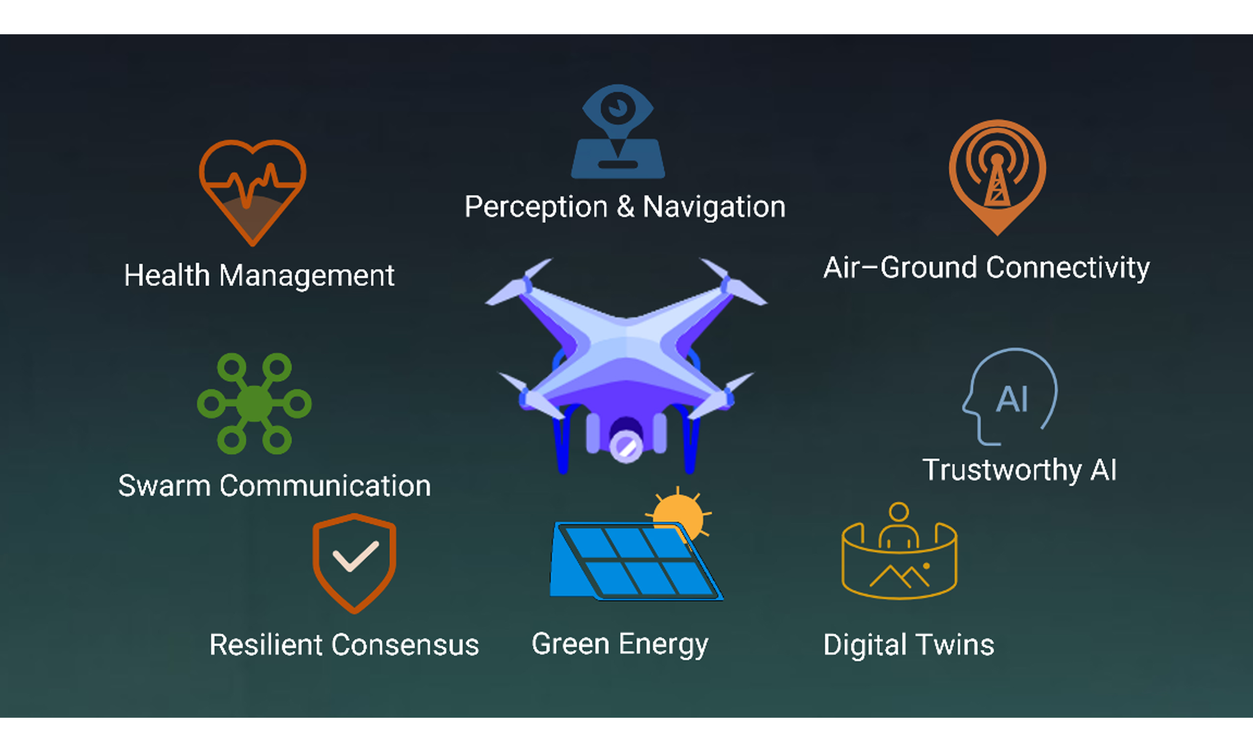
To explore the current landscape and future outlook of UAV technology, we analyze the papers in the Special Issue “Advances in Unmanned Aerial Systems: Technologies, Applications, and Challenges.” Their insights combine into four topical hotspots that define today’s UAV innovation landscape.
(1) Health Management for UAVs. Focuses on onboard monitoring and intelligent fault diagnosis to extend UAV airframe service life and ensure safe flight operations across diverse mission profiles.
(2) Perception and Autonomous Navigation for UAVs. Investigates robust localization and mapping methods to enable dependable flight in Global Positioning System (GPS)-denied or challenging, degraded environments, leveraging integrated vision and inertial data for precise control.
(3) Communication and Coordination for UAV Swarms. Employs secure, energy-efficient communication protocols and cooperative task-allocation strategies to coordinate multi-UAV missions.
(4) Resilient UAV Air-Ground Links and Path Planning. Integrates channel-intelligence models of UAV air-ground propagation with optimized path planning to ensure UAVs maintain robust connectivity in dynamic environments.
2. HEALTH MANAGEMENT FOR UAVS
2.1. Paper overview
Yuan et al.[3] propose a real-time health status assessment scheme for the attitude control system (ACS) of fixed-wing UAVs. First, they build a dynamic memory matrix
By comparing Xest against Xobs, they derive each component’s normalized deviation. Finally, using the analytic hierarchy process (AHP) to assign reconfigurability-based weights, they aggregate these deviations into a single ACS health score. Simulation results show that when faults were injected at 500 s and 900 s, the method accurately tracks both each component’s abnormal degree and the overall ACS health status indicator in real time.
2.2. Critical commentary
The scheme’s strengths include adaptive memory construction via a double-K process that keeps the memory matrix aligned with changing flight dynamics. By feeding multivariate state estimation (MSET)-based residuals into a sequential probability ratio test (SPRT) framework, it produces a bounded anomaly index sensitive to both sudden faults and gradual drifts. Finally, the health indicator uses an AHP weighting scheme based on subsystem reconfigurability, ensuring that critical components contribute proportionally to the overall ACS score.
However, the online clustering and memory updates can overload onboard processors during high-speed or long-duration missions, indicating a need for lightweight or threshold-based update schemes. The SPRT’s assumption of Gaussian residuals may break down under non-Gaussian noise in turbulent flight, suggesting that robust or non-parametric tests could improve reliability. Finally, using expert-driven AHP weights introduces subjectivity and limits portability across UAV platforms; automated weight tuning with historical failure data could address this issue.
2.3. Current landscape and outlook
Current UAV health management spans three interconnected domains. At the component level, Yuan et al.[3] propose a real-time ACS framework to quantify UAV health. At the operational level, Asghari et al.[4] survey risk assessment models and traffic management strategies that set safety envelopes and compliance paths for UAVs in shared airspace. At the software level, Di Sorbo et al.[5] apply machine learning to detect and rank safety-critical defects in control code before flight.
Despite these advances, the domains remain isolated because in-flight diagnostics rarely inform policy, operational models seldom use live health data, and software feedback loops stop short of deployment. Closing these gaps requires a unified ecosystem that combines component monitoring, defect records, and risk assessment. Future work should develop real-time digital twins, federated health learning, and open datasets within regulation-aware frameworks to ensure safe, scalable UAV operations.
3. PERCEPTION AND AUTONOMOUS NAVIGATION FOR UAVS
3.1. Paper overview
Tong et al.[6] address the dual challenges of irregular scanning and limited field of view in solid-state light detection and ranging (LiDAR) by incorporating intensity feature points with geometric ones for state estimation. The front-end pipeline first filters motion‐distortion and blind-spot outliers, and then classifies planar and edge features based on local curvature.
In the back-end stage, geometric and intensity residuals are balanced via a consistent difference function, allowing the simultaneous localization and mapping (SLAM) system to sustain accurate localization and mapping under feature-scarce or otherwise adverse conditions. Experiments on both indoor and outdoor datasets demonstrate absolute trajectory error reductions of 54.5% and 29.6%, and relative pose error improvements of 5.3% and 58.8%, respectively.
3.2. Critical commentary
The primary strength of Tong et al.[6] is the use of intensity smoothness as an additional feature to offset geometric sparsity in flat or repetitive scenes. Combined with multithreaded segmentation matching and motiondistortion correction, this approach achieves real-time performance.
However, the intensity-normalization model only accounts for range and incidence angle, neglecting material properties and atmospheric effects, which may introduce noise. Key parameters, such as region partitioning and feature weighting, are set empirically rather than learned. Future work should pursue adaptive parameter learning, incorporate richer physical models or semantic and depth priors, and explore sensor fusion (e.g., vision or radar) to improve robustness and mapping accuracy in complex environments.
3.3. Current landscape and outlook
Recent UAV perception and navigation leverage multimodal sensing and real-time predictive planning. For example, vision-based detectors [e.g., You Only Look Once (YOLO)] enable obstacle recognition; event cameras and radar bolster robustness. Fused geometric-intensity LiDAR SLAM and visual-inertial odometry improve localization. Intent-prediction model predictive control (MPC)[7] ensures collision-safe trajectories, and semantic visual navigation[8] supports mapless, goal-directed exploration.
Future UAV navigation will rely on tighter integration of LiDAR, vision, and radar sensing with learned models and careful calibration to minimize drift. Motion planning should merge data-driven intent inference with MPC. Embedding semantic priors and explainable Artificial Intelligence (AI) techniques will enhance situational awareness. Finally, advancing sim-to-real transfer through domain adaptation and metalearning will improve robustness in GPS-denied environments.
4. COMMUNICATION AND COORDINATION FOR UAV SWARMS
4.1. Paper overview
Ali et al.[9] introduce a decentralized UAV communication framework combining Multi-Agent Deep Reinforcement Learning (MADRL) with Distributed Ledger Technology (DLT). Each UAV runs its own Independent Proximal Policy Optimization (IPPO) agent, receiving observations of nearby UAVs and ground users (GUs) along with aggregate throughput and fairness metrics. Simulation results show that this framework outperforms traditional baseline algorithms across key metrics of throughput, fairness, and energy consumption.
Peng et al.[10] address the problem of constructing a three‐dimensional electromagnetic target situation map through multi-UAV collaboration. Their pipeline begins with an improved Maximum-Minimum Distance (MMD) clustering to quickly obtain coarse emitter locations from sparse received signal strength (RSS) samples. Next, a re-weighted Least Absolute Shrinkage and Selection Operator (LASSO)‐based fusion algorithm refines the reconstructed signal map by enforcing sparsity and suppressing outliers. Finally, fine‐scale position corrections are performed on a local 3D grid. Simulations in a complex campus environment confirm the method’s ability to generate high‐precision electromagnetic situational maps.
4.2. Critical commentary
Innovations in both studies arise from integrating advanced algorithms into unified frameworks. Ali et al.[9] propose a fully decentralized multi-agent deep reinforcement learning system based on IPPO, using a composite reward function to balance fairness, throughput, and energy efficiency, while blockchain secures policy exchanges at scale. Peng et al.[10] introduce a three-stage pipeline anchored in realistic propagation models to counter sparse sampling. These works demonstrate that combining learning algorithms, distributed ledger technology, and signal-processing models yields robust, adaptable UAV swarms.
Despite their advances, both methods reveal significant challenges. The MADRL with deep learning (DL) framework imposes extra computational and energy costs and assumes ideal free-space channels, limiting its real-world applicability without more realistic propagation models. The pipeline of Peng et al.[10], though precise, relies on manually set clustering thresholds and penalty weights, risking brittle performance in diverse environments. Future work should therefore investigate energy-aware, adaptive reward functions, lightweight ledger alternatives, and metalearning-based parameter tuning to overcome these limitations.
4.3. Current landscape and outlook
Recent UAV-swarm research focuses on three areas: hybrid networking, decentralized control, and collaborative sensing. Integrating UAV-to-UAV links with infrastructure channels extends coverage and strengthens reliability. At the same time, multi-agent reinforcement learning and lightweight consensus protocols enable distributed trajectory planning, resource allocation, and data fusion, thereby improving mission efficiency without a central controller[11,12].
Future directions include energy-aware federated learning and seamless integration of both 6G and self-organizing networks to enable on-board model training and ultra-reliable, low-latency links in three-dimensional environments. Dynamic self-organization protocols will bolster swarm resilience and security. Finally, AI-driven edge-cloud collaboration for real-time mapping, target tracking, and autonomous reconfiguration will drive UAV swarms toward fully autonomous, robust, and energy-efficient multi-agent systems.
5. RESILIENT UAV AIR-GROUND LINKS AND PATH PLANNING
5.1. Paper overview
Zhang et al.[13] introduce a scenario-transfer back-propagation neural network (BPNN) to predict millimeter-wave UAV air-ground path loss in urban settings. This paper parameterizes scene geometry alongside link factors, training the model on Wireless InSite ray-tracing data from multiple virtual city layouts.
To ensure the network minimizes deviation from ray-traced references during back-propagation. The results show that the BPNN produces negligible line-of-sight error and a modest non-line-of-sight root mean square error (RMSE), outperforming the 3rd Generation Partnership Project (3GPP) model.
5.2. Critical commentary
The strengths include parameterizing urban geometry and employing a lightweight BPNN to deliver accurate line-of-sight and non-line-of-sight predictions with minimal computational overhead. This work paves the way for applying scenario-transfer methods in other communication scenarios and for developing hybrid data-driven models for rapid onboard link assessment.
However, relying solely on synthetic ray-tracing data limits real-world accuracy, since material variability, dynamic obstacles, and atmospheric effects are not captured. Future work should incorporate field measurements for model calibration and expand the framework to jointly optimize flight paths, power control, and real-time environmental sensing.
5.3. Current landscape and outlook
Resilient UAV air-ground communications now integrate robust channel modeling, adaptive link control, and trajectory optimization into unified frameworks. Scene-transfer neural predictors estimate path loss accurately across varied urban environments without exhaustive measurements. Relay-based swarm algorithms[14] and mobile-gateway schemes extend coverage and conserve energy by dynamically repositioning UAVs and using low power wide area networks (LPWAN) protocols[15,16]. Cross-layer designs combine lightweight neural estimators with real-time modulation and power control to maintain connectivity and capacity in complex or contested environments.
Future research should validate these simulation-driven methods through large-scale field trials that incorporate material variability, weather dynamics, and unplanned interference. Integrating onboard sensing (e.g., vision, radar)[17] with AI-guided replanning in joint link-and-flight planning frameworks will enhance resilience to obstacles and jamming. Finally, exploring distributed learning and blockchain-enabled secure link management can enable autonomous, self-healing air-ground networks that meet
6. COMPREHENSIVE COMMENTARY AND FUTURE DIRECTIONS
6.1. Comprehensive commentary
The papers in this Special Issue establish a unified UAV ecosystem encompassing health management, perception and navigation, swarm coordination, channel modeling, and path planning. The review integrates the contributions of multiple papers into four subject areas: UAV health management, perception and autonomous navigation, swarm communication, air-ground connection, and path planning. This helps readers grasp the current progress and future direction of UAV technology as a whole. The contribution of each paper is critically reviewed in detail, and its advantages and potential limitations are pointed out. These comments provide specific suggestions and directions for future research.
Health management solutions use real-time fault detection, adaptive memory matrices, and digitaltwin simulations to monitor platforms continuously and generate predictive alerts. Perception and navigation systems combine LiDAR geometry and intensity data with vision and inertial measurements to maintain accurate localization and mapping.
Building on these foundations, swarm coordination combines decentralized multi-agent reinforcement learning with lightweight blockchain protocols. This approach secures task assignment, reduces energy consumption, enables policy exchange, and achieves in-flight consensus. Channel modeling employs scenario-transfer neural networks trained on ray-tracing data to produce precise mmWave and THz
Finally, path planning algorithms integrate communication quality and energy constraints into trajectory optimization, balancing connectivity and efficiency. Collectively, these components form a cohesive framework that enables reliable, adaptive UAV operations in dynamic, contested, or infrastructure-limited environments.
These papers demonstrate advances in UAV health management, perception, coordination, communications, and path planning. They enable integrated approaches that harness each domain’s strengths to address the complex challenges of future UAV missions. Several key directions of UAV technology development in the future are put forward, including adaptive connection, reliable intelligence, unified data ecosystem and sustainable energy. These directions provide researchers and practitioners with clear future research paths.
In addition to these four key domains, malicious attacks represent a critical challenge that UAV networks must explicitly address. In real-world deployments, mobile adversaries may compromise nodes, inject false data, or exploit time-varying delays to disrupt consensus and coordination. Recent studies have developed resilient consensus mechanisms, such as vector consensus protocols over random dynamic networks under mobile malicious attacks, and resilient consensus algorithms for multi-agent systems with time-varying delays and adversarial nodes. These works provide a solid theoretical foundation for ensuring stability and reliability in adversarial environments. Future research should further integrate such resilient consensus strategies with UAV health management, blockchain-based coordination, and trustworthy AI, thereby establishing a unified defense framework against both faults and attacks, and significantly enhancing the security and robustness of UAV networks.
Malicious attacks are indeed an important issue that needs attention in UAV networks. The following are some key tasks mentioned in the document:
1. The elastic vectors of random dynamic networks under mobile malicious attacks are the same:
This direction focuses on how to maintain vector consistency when facing mobile malicious attacks in random dynamic networks. This involves how to design algorithms to resist the influence of malicious nodes and ensure that nodes in the network can reach a consistent decision under the changing network topology.
2. The flexibility of multi-agent networks with time-varying delays is the same as that of mobile opponents:
This direction focuses on achieving elastic consistency in the presence of time-varying delays and mobile opponents in multi-agent systems. Time-varying delays refer to communication latencies that change over time, while mobile opponents denote malicious nodes or attackers that move within the network. The goal of this line of research is to design algorithms that maintain system stability and consistency under these unfavorable conditions.
These key tasks aim to improve the flexibility and robustness of UAV networks in the face of malicious attacks and to ensure the stable operation of UAV systems in unsafe environments. Through this research, the safety and reliability of the UAV system can be enhanced, making it more stable and reliable in practical applications.
6.2. Future directions
Future research could investigate hybrid network architectures that combine high-capacity millimeter-wave or terahertz links with sub-6 GHz cellular, LPWAN protocols such as long range (LoRa) and narrowband-Internet of Things (NB-IoT), and emerging spectrum-sharing schemes. Coordinating radio resources and control across edge nodes and cloud services can minimize handover delays, balance load, and ensure seamless interoperability among heterogeneous links under dynamic mission requirements.
Future research should explicitly address adversarial environments as a central challenge. Designing resilient consensus algorithms that tolerate mobile adversaries, false data injection, and time-varying communication delays will be essential for securing UAV networks in practice. Integrating these mechanisms with trustworthy AI, federated health monitoring, and blockchain-based coordination can establish a comprehensive “fault-attack unified” defense framework.
Control architectures could adopt trustworthy AI alongside verifiable computing. For example, federated learning and differential privacy can protect sensitive model updates, while zero-knowledge proofs or lightweight blockchain channels can validate policy exchanges without exposing mission data. Progress will accelerate if the community publishes diverse open datasets. Finally, defining UAV-specific application programming interfaces (APIs) and data formats within the upcoming 3GPP and Institute of Electrical and Electronics Engineers (IEEE) standards will enhance interoperability and promote collaborative innovation.
Longer endurance and lower environmental impact may be achieved by advancing green energy and harvesting solutions. Solar-augmented wings, Radio Frequency (RF) energy scavenging modules, small fuel cells, and bio-fuel converters, together with adaptive power-management strategies, can boost flight time and energy efficiency. Developing federated digital-twin frameworks and real-time simulation platforms will enable live health monitoring, predictive maintenance, and coordinated mission rehearsals across multiple UAVs. These virtual environments can support regulatory testing, streamline certification, and pave the way for scalable, resilient deployments in complex operational theaters. Real-time simulation platforms are one of the most promising development directions.
An important research priority is to develop a federal digital twin framework and a real-time simulation platform to support real-time health monitoring, predictive maintenance and multi-UAV collaborative task drills. Table 1 summarizes the key future research directions, their primary focus areas, and the main considerations for advancing UAV systems:
Future UAV research directions overview
| Research area | Focus | Key challenge |
| Adaptive connectivity Embodied and trustworthy intelligence Unified data ecosystem and standards Sustainable energy and endurance Digital twins and mission coordination | Multi-spectrum link adaptation Onboard AI with verifiable security Open datasets and APIs Energy harvesting and management Live simulation and coordination | Coordinating heterogeneous protocols and handovers Balancing model complexity, security, and resources Harmonizing formats and governance Optimizing conversion efficiency versus payload Ensuring fidelity, synchronization, and low latency |
| Resilient consensus under adversarial environments | Fault-attack unified defense framework | Maintaining stability and consistency under mobile adversaries, false data injection, and time-varying delays |
7. CONCLUSIONS
This Special Issue demonstrates how real-time health monitoring enhances LiDAR-vision-inertial fusion to enable GPS-resilient navigation, which in turn supports decentralized swarm coordination using lightweight ledger protocols. Scenario-transfer neural predictors refine high-frequency link estimates and inform trajectory planning to balance connectivity and endurance. Future work could integrate onboard intelligence with unified networking and renewable power in live digital-twin environments, creating a scalable, resilient, and sustainable UAV architecture. The findings highlight the importance of integration across different fields-such as health management, perception and navigation, swarm communication, and air-ground connectivity-to realize fully autonomous, scalable, and sustainable UAV operations. This
DECLARATIONS
Acknowledgments
Some of the icons used in the graphical abstract are sourced from Iconfont Library (https://www.iconfont.cn/collections/index?spm=a313x.7781069.1998910419.3).
Authors’ contributions
Made substantial contributions to conception and design of the study and performed data analysis and interpretation: Zhao, X.; Chen, C.
Conducted the literature survey, synthesized the Special-Issue papers, and drafted the initial manuscript: Zhao, X.
Provided critical revision of intellectual content: Xu, Z.
Availability of data and materials
Not applicable.
Financial support and sponsorship
This work is supported by the National Natural Science Foundation of China under grants 62402221; the Science Foundation of Jiangsu Province under Grant BK20241379.
Conflicts of interest
Zhao, X. is affiliated with COMAC Shanghai Aircraft Manufacturing Co., Ltd, while the other authors have declared that they have no conflicts of interest.
Ethical approval and consent to participate
Not applicable.
Consent for publication
Not applicable.
Copyright
© The Author(s) 2025.
REFERENCES
1. Jiang, Y.; Li, X.; Zhu, G.; et al. Integrated sensing and communication for low altitude economy: opportunities and challenges. IEEE. Commun. Mag. , 2025, 1-7.
2. Ye, X.; Mao, Y.; Yu, X.; Sun, S.; Fu, L.; Xu, J. Integrated sensing and communications for low-altitude economy: a deep reinforcement learning approach. IEEE. Trans. Wirel. Commun. 2025.
3. Yuan, R.; Shao, S.; Chen, M. Health status assessment of unmanned aerial vehicle (UAV) attitude control system based on an improved multivariate state estimation method. Complex. Eng. Syst. 2024, 4, 10.
4. Asghari, O.; Ivaki, N.; Madeira, H. UAV operations safety assessment: a systematic literature review. ACM. Comput. Surv. 2025, 57, 1-37.
5. Di Sorbo, A.; Zampetti, F.; Visaggio, A.; Di Penta, M.; Panichella, S. Automated identification and qualitative characterization of safety concerns reported in UAV software platforms. ACM. Trans. Softw. Eng. Methodol. 2023, 32, 1-37.
6. Tong, X.; Li, J.; Zhao, C. Intensity enhanced for solid-state-LiDAR in simultaneous localization and mapping. Complex. Eng. Syst. 2024, 4, 11.
7. Xu, Z.; Jin, H.; Han, X.; Shen, H.; Shimada, K. Intent prediction-driven model predictive control for uav planning and navigation in dynamic environments. IEEE. Robot. Autom. Lett. 2025, 10, 4946-53.
8. Yue, P.; Xin, J.; Zhang, Y.; Lu, Y.; Shan, M. Semantic-driven autonomous visual navigation for unmanned aerial vehicles. IEEE. Trans. Ind. Electron. 2024, 71, 14853-63.
9. Ali, F.; Ahtasham, M.; Anfaal, Z. Enhancing unmanned aerial vehicle communication through distributed ledger and multi-agent deep reinforcement learning for fairness and scalability. Complex. Eng. Syst. 2024, 4, 14.
10. Peng, Y.; Liu, K.; Cai, X.; Wang, J.; Lin, Z. Multiple unmanned aerial vehicle collaborated three-dimensional electromagnetic target situation map construction. Complex. Eng. Syst. 2024, 4, 15.
11. Javaid, S.; Saeed, N.; Qadir, Z.; et al. Communication and control in collaborative UAVs: recent advances and future trends. IEEE. Trans. Intell. Transport. Syst. 2023, 24, 5719-39.
12. Xiong, R.; Xiao, Q.; Wang, Z.; Xu, Z.; Shan, F. Leveraging lightweight blockchain for secure collaborative computing in UAV Ad-Hoc networks. Comput. Netw. 2024, 251, 110612.
13. Zhang, G.; Lei, T.; Huo, X.; et al. Path loss prediction for air-to-ground communication links via scenario transfer technology. Complex. Eng. Syst. 2024, 4, 18.
14. Yin, D.; Yang, X.; Yu, H.; Chen, S.; Wang, C. An air-to-ground relay communication planning method for UAVs swarm applications. IEEE. Trans. Intell. Veh. 2023, 8, 2983-97.
15. Chen, C.; Luo, J.; Xu, Z.; Xiong, R.; Shen, D.; Yin, Z. Enabling large-scale low-power LoRa data transmission via multiple mobile LoRa gateways. Compu. Netw. 2023, 237, 110083.
16. Chen, C.; Luo, J.; Xu, Z.; et al. Loradrone: Enabling low-power lora data transmission via a mobile approach. 2022. 18th. International. Conference. on. Mobility,. Sensing. and. Networking. (MSN),. , IEEE, 2022, pp.239-46.
Cite This Article
How to Cite
Download Citation
Export Citation File:
Type of Import
Tips on Downloading Citation
Citation Manager File Format
Type of Import
Direct Import: When the Direct Import option is selected (the default state), a dialogue box will give you the option to Save or Open the downloaded citation data. Choosing Open will either launch your citation manager or give you a choice of applications with which to use the metadata. The Save option saves the file locally for later use.
Indirect Import: When the Indirect Import option is selected, the metadata is displayed and may be copied and pasted as needed.
About This Article
Copyright

Data & Comments
Data
0


Comments
Comments must be written in English. Spam, offensive content, impersonation, and private information will not be permitted. If any comment is reported and identified as inappropriate content by OAE staff, the comment will be removed without notice. If you have any queries or need any help, please contact us at [email protected].